Tropical Storm Faye brought heavy rainfall to the Southeast in August of 2008. Unfortunately the rain arrived mid-week and I wasn't able to enjoy the water until the weekend. On Saturday, one of the remaining options was the Upper Chattahoochee and fortunately, my friend Steve was nice enough to invite me along on a trip with some of his friends from further down in Georgia. Thanks guys!
Allen Pogue Steve Smyth Edward Stockman Douglas ? Allen Hedden
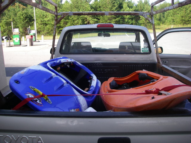
The symbolism of boats lined up on the way to the river. Though the image is a still life, it hints and suggests action.
I wasn't able to get any time off during the arrival of the remnants of Tropical Storm Faye. Fortunately there were still a few things running four days later, including the upper section of the Chattahoochee River in Georgia. The "Upper Hooch," as it is known is a free flowing class II-III run that ends up in Lake Lanier. The weather was excellent, if a little hot, and the level was sufficient, around 700 cfs early in the morning, slowly dropping throughout the day. Steve assured me that it was the highest he had run it.
The water was slightly cloudy and had a peculiar smell to it. I'm not sure if this was due to impurity or if it was some natural odor. I decided not to worry about, being glad to run a free-flowing river for the first time in a few months.
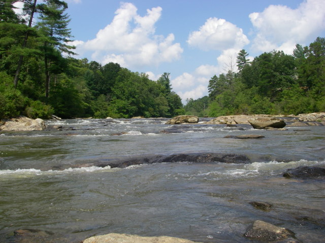
The geology of the river shortly downstream from the launch features a lot of boulders and bedrock formations. At the level we had, this made for highly technical class II.
A typical ledgy boulder garden on the Upper Hooch.
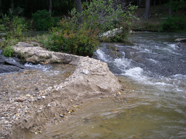
There were frequent signs of the recent high water levels in the Hooch, mostly in the form of obvious erosion of sand deposits. Many were cleanly cut away to expose the lamina.
Alluvial features were heavily eroded due to the recent high water levels. In some cases, sand bars were sliced off and the layers of sand were clearly visible.
After a somewhat lengthy shuttle-setting process due to some confusion about the proper meeting point (situation normal), we got underway. The Upper Hooch immediately impressed me with more rapids than I anticipated. I had been expecting more of a class I-II run but the river has many solid class II and even some II+ rapids with numerous possible lines and an abundance of play spots. Most of the play spots are of the type suitable for squirt moves and flat surfing moves such as flat spinning. The lines tend to be very technical and the riverbed is a maze of shelves, slots, chutes, and boulders. It's an eddy-hopping playground.
In terms of scenery, the Upper Hooch was much better than I expected. There are some houses and well-marked private property, but for the most part the run is tree-lined, with some cool rock formations in places. You can easily imagine that you are immersed in wilderness, at least during a few lengthy segments.
The only thing that detracted from the experience was the abundance of outfitter clients and non-PFD-wearing locals. At first we didn't see many other paddlers, but after a while we started to see a lot of rental boats and "civilian" amateurs on surf-skis and ocean sit-on-tops. There were a few guys in jeans, tennis shoes, and t-shirts, with no sign of a life jacket. As far as I could tell, they swam every single rapid. You could always look ahead into the distance to identify the next rapid by the fact that someone would always be standing up in it trying to turn their sit-on-top right side up.
Rapids are easy to identify by the presence of people standing up next to a sit-on-top. Usually the sit-on-top is upside down. This guy already recovered by the time I took the photo.
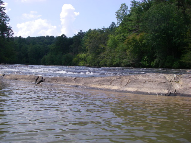
Slightly different geology seems to prevail further into the run, with more even shelves, not unlike the Hiwassee.
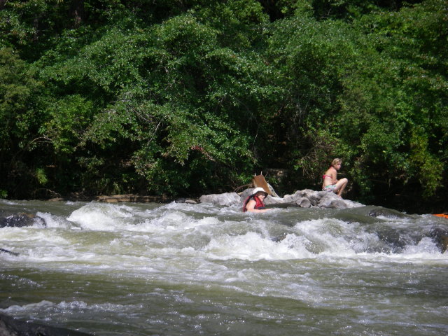
Eventually the geology seemed to change a bit and there were more even ledges, until we got to the last big rapid, Horseshoe. Horseshoe was the most interesting single drop to run, although the adrenaline was somewhat stymied by the fact that some kid just deliberately jumped in and swam the rapid like it was no big deal.
A wide view of Horseshoe, featuring a family portaging the rapid across the exposed rock shelf. We took a line on the right of the image (river left). It was slightly more difficult than it looks in the photos here.
Kid downgrades the rapid by climbing into it and swimming through what appeared to be a very shallow slot.
After Horseshoe, the river quieted down a bit, with only a few minor class I rapids and plenty of time to talk before we reached the takeout. It was another great day on the river and I get to add a new stream to my list. Thank you Steve Smyth, Edward Stockman, Douglas, and Allen Hedden for allowing me to join them for some tropical storm free flowing water.